Neighborhood Level Convergence InfoMaps
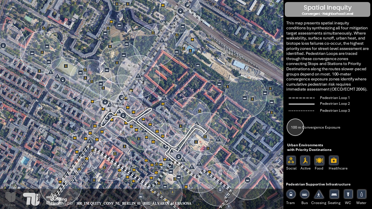
Research Phase
The evidence at this phase organizes across two levels:
Neighborhood Level:
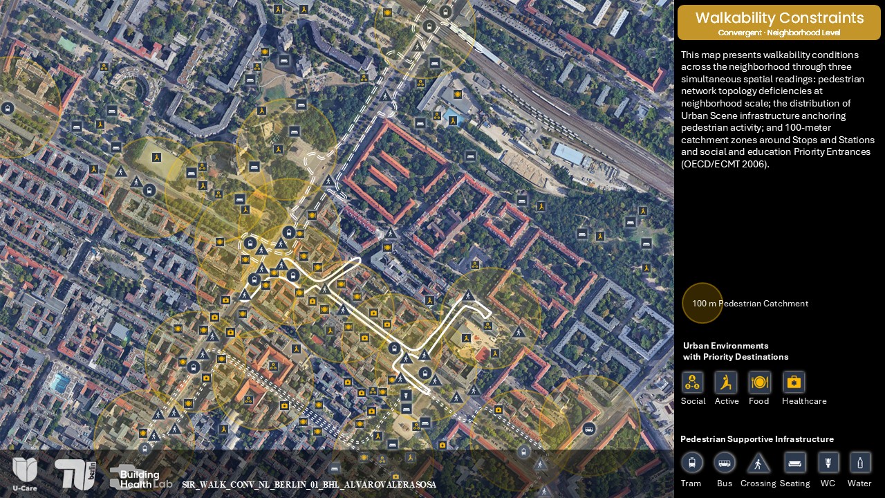
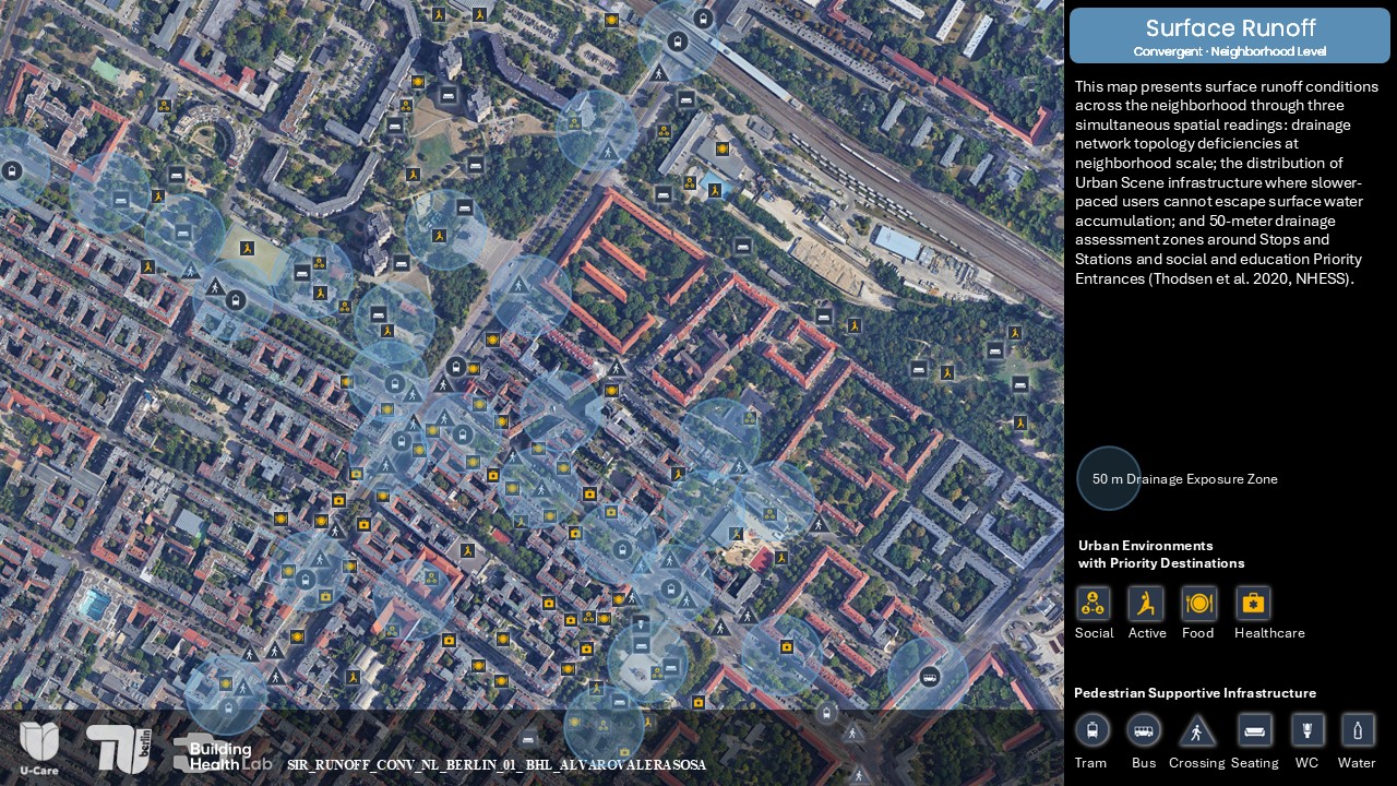
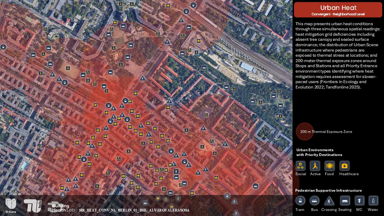
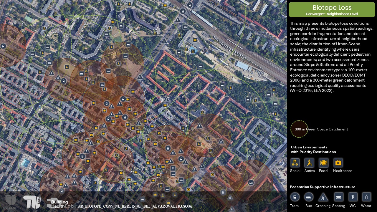
Five maps show where walkability constraints, surface runoff, urban heat, and biotope loss accumulate and where they converge into spatial inequity zones.
Click any map to view it in full screen.
Street Level:
An interactive point cloud scene documents conditions along Pedestrian Loop 2. Click the image to enter the IVION environment and explore the loop scene by scene.
EXPLORE THE CASE
Use the left panel to Explore the Neighborhood Level and Street Level evidence.