Pedestrian Loop Integrated Design
Design Phase
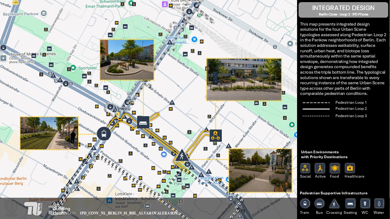
This phase translates the Planning Brief into spatial proposals at two scales.
Neighborhood Level:
The Pedestrian Loop Design Map shows the proposed interventions along the full extent of Loop 2, integrating the four mitigation targets into a coherent spatial strategy.
Street Level:
Four Urban Scene renders present the proposed design conditions at key pedestrian locations along the loop. Each render shows the before and after transformation for stops and stations, crossings, respite areas, and priority entrances.
EXPLORE THE CASE
Use the left panel to Explore the Neighborhood Level and Street Level evidence.