The U-Care Platform
Transforming Urban Health Evidence into Spatial Decisions
What you are seeing is a real street in Berlin. This is where urban health is produced or degraded — not in policy documents, but in the everyday conditions pedestrians encounter when they walk, wait, and move through cities.
The U-Care Platform structures how these conditions are observed, analyzed, and transformed into planning and design decisions.
Experience the Platform
Participants are invited to explore a live urban case from Berlin, to experience how urban health spatial interventions develop in neighborhoods around priority destinations.
The exercise demonstrates how one case addresses three structural issues most cities share:
- A data quality gap at street level
- Fragmented decision-making
- Single-purpose designs
When you are ready, click below to enter the platform and start with the Research Phase.
The problem
Cities increasingly commit to health, equity, and climate goals. The gap lies in translating those commitments into effective action at street level.
Tackling the Triple Bottom Line
Data Quality Gap
Urban datasets typically operate at aggregated scales. While they support strategic planning, they do not provide the street-level evidence needed to understand how everyday pedestrian environments shape climate risks, unhealthy exposures, and their economic consequences. Without this level of resolution, interventions lack a reliable basis for prioritization, integration, and design.
Fragmented Decision-Making
Urban departments responsible for mobility, public health, climate adaptation, and public space often operate through separate datasets, objectives, and workflows. This fragmentation produces duplicated effort, conflicting priorities, and missed opportunities for integrated solutions that deliver climate, health, and economic benefits simultaneously.
Single-Purpose Design
Many urban interventions address one problem while underperforming on others. A street redesign may improve drainage without reducing heat exposure. A greening project may enhance biodiversity without improving walkability. Without a shared evidence framework, interventions rarely generate the compounded climate, health, and economic benefits that justify their cost.
The approach
UrbanCare
UrbanCare is the methodological framework that underpins the U-Care project, using spatial inequity as a strategic lens to connect street-level evidence with city-scale transformation.
Rather than treating urban health risks in isolation, UrbanCare examines how environmental burdens accumulate along everyday pedestrian routes, particularly for slower-paced users whose movement characteristics increase exposure and effort. By shifting attention from who people are to how they move, the framework identifies where urban systems fail under real-world conditions and where targeted interventions can generate disproportionate benefits.
UrbanCare structures each urban case through a consistent Research, Planning, and Design workflow that addresses the triple bottom line. Evidence collected at the pedestrian scale remains traceable, comparable, and actionable across planning, design, and policy decisions, enabling integrated responses that improve climate resilience, public health, and economic performance.
Four Mitigation Targets
Walkability
Fragmented pedestrian networks, discontinuous paths, and poorly designed crossings increase physical effort and travel time while limiting safe and comfortable movement. These conditions discourage everyday walking, contribute to sedentary health risks, and reduce the efficiency of local mobility systems and street-level economic activity.
Surface Runoff
Sealed surfaces and insufficient drainage lead to surface flooding, water accumulation, and contamination along walking routes. These conditions compromise pedestrian safety, disrupt daily mobility, and increase maintenance costs, infrastructure damage, and long-term financial burdens for municipalities.
Urban Heat
Heat-absorbing materials, limited shading, and poor ventilation intensify thermal stress at street level, particularly where pedestrians slow down or wait. Elevated heat exposure increases health risks, reduces outdoor usability, and drives higher energy demand and economic losses linked to reduced productivity and comfort.
Biotope Loss
The degradation and fragmentation of vegetated systems weaken cooling, water regulation, and ecological continuity in urban environments. These losses intensify environmental stress, diminish public space quality, and contribute to long-term economic costs through increased climate vulnerability and reduced ecosystem services.
How this platform works
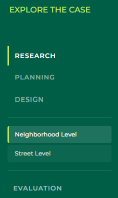
Step 1: Start with a Case
Each case evaluates a real urban area selected for its relevance to everyday pedestrian activity and public health conditions.
Step 2: Follow Pedestrian Loops
Pedestrian loops of approximately two kilometers structure neighborhood-scale assessment and reflect everyday walking routes, connecting recurring street-scale observation points.
Step 3: Focus on Urban Scenes
Street-scale analysis concentrates on key locations where pedestrians slow down, wait, or reroute: stops and stations, street crossings, respite areas, and priority entrances to essential daily functions.
Step 4: Assess Four Mitigation Targets
Walkability, surface runoff, urban heat, and biotope loss are assessed across neighborhood and street scales. Spatial inequity is examined across all four targets.
Step 5: Interpret and Act
Filtered views and cross-case comparisons allow users to assess environmental exposures, identify planning priorities, and evaluate potential interventions across cities, neighborhoods, and urban scenes.
Who it is for
The U-Care Platform primarily serves the academic and educational activities of the U-Care project. It is designed to support research, teaching, and learning in the fields of urban planning, public health, and climate-responsive urban development, while also offering insights that are relevant to professional and policy contexts.
Students and educators
Within higher education, the platform supports case-based learning in urban planning, architecture, public health, and related fields. Students can explore how everyday street conditions shape health and climate exposure, while educators can integrate real urban cases and comparative analysis into teaching.
Urban planners, designers, and practitioners
For professional audiences, structured street-level evidence helps bridge strategic objectives and local implementation. The platform supports the diagnosis of pedestrian environments and the interpretation of environmental exposure, highlighting where targeted interventions can improve health, equity, and resilience.
Public authorities and policymakers
Accessible and comparable outputs support cross-departmental dialogue, policy development, and evaluation. The platform is particularly relevant for teams working on mobility, public space, public health, and climate adaptation.
Researchers and analysts
Across academic and applied research, the platform enables the exploration and comparison of validated results across cities and contexts. A shared analytical framework supports cross-case learning, mixed-method interpretation, and the integration of spatial, environmental, and perception-based evidence.
Facilitators and workshop organisers
As a common reference point for participatory processes, the platform provides a shared evidence base for stakeholder workshops and learning activities. It supports structured discussion, transparent interpretation, and the documentation of insights that can inform planning, teaching, and policy processes.
U-Care courses
U-Care Courses provide structured learning on urban health, environmental assessment, and evidence-based urban planning and design. These courses combine academic learning modules developed by project partners with practical guidance on how to use the U-Care Platform and interpret its outputs.
About the U-Care Project
U-Care is an Erasmus+ funded project focused on studying and transforming urban ecosystems to improve health outcomes across European cities in diverse climatic contexts.
The project applies the UrbanCare methodological framework to integrate urban health research, neighbourhood-level diagnostics, and participatory decision-making into higher education, supporting the development of skills and methods needed to address the impacts of climate change on urban environments. It is implemented through a collaboration between European universities, SMEs, and research organisations, including Building Health Lab, Technische Universität Berlin, Università degli Studi di Firenze, Chalmers Tekniska Högskola, the University of Cyprus, and RESET.